Gander Automated Air Traffic System vs Air route traffic control centers
Gander Automated Air Traffic System (GAATS)
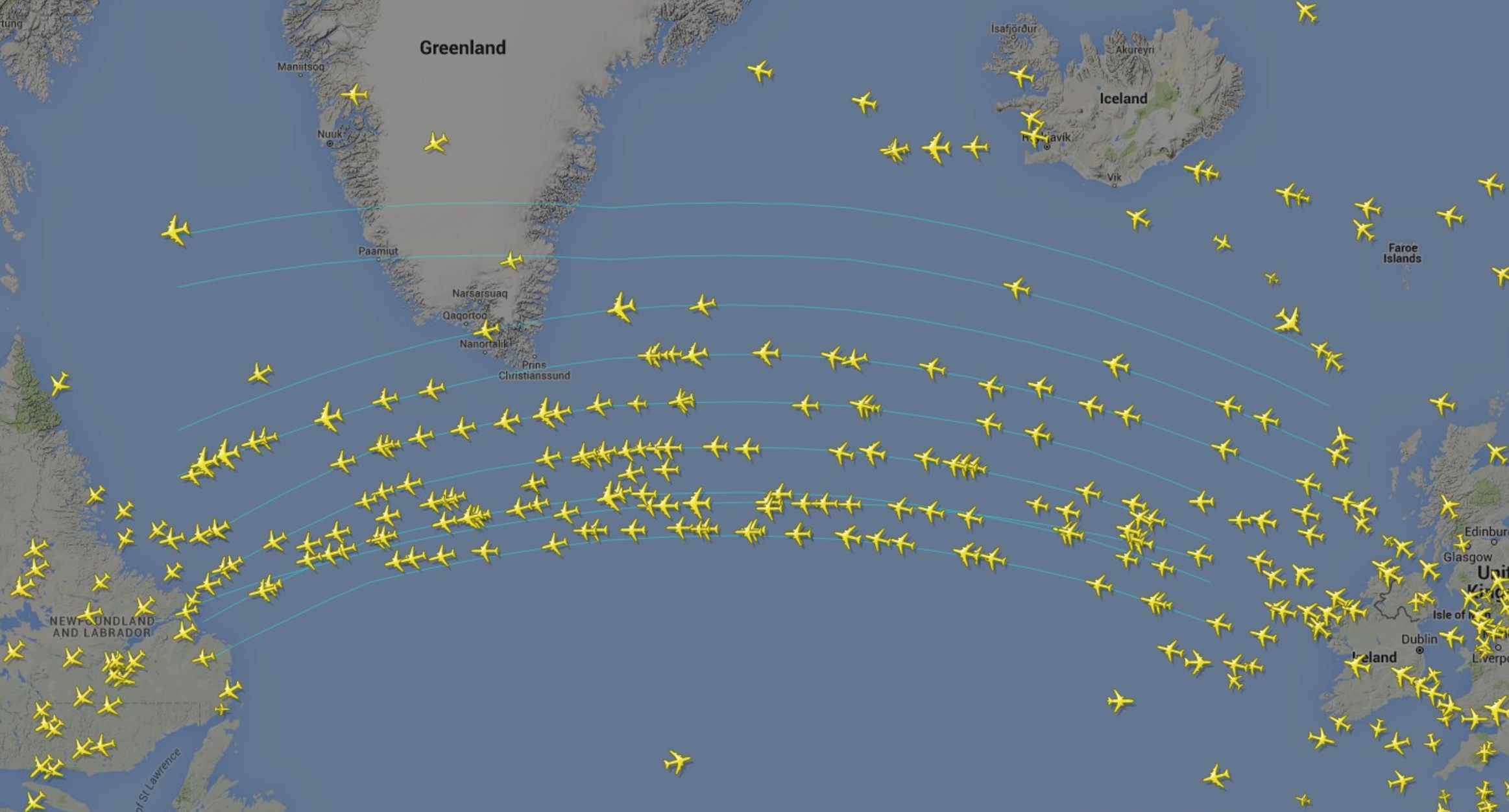
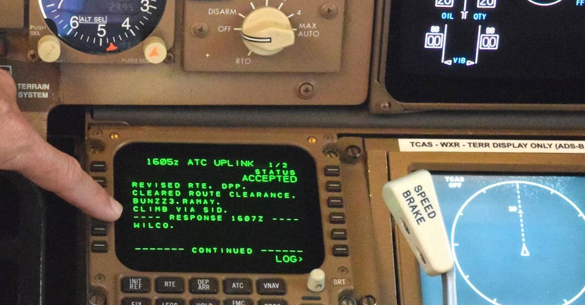
The GAATS is used for the oceanic airspace of the Gander area and is used for airspace navigations between airports in that area (NAV Canada, n.d.). As the oceanic airspace does not make use of radars like continental airspace, the GAATS makes up for that difference by providing controller workstations in that area with a clear visualization of where aircraft are at by providing real-time viewing of the oceanic traffic in picture form, similar to that of a radar (NAV Canada, n.d.). Flying over the oceanic airspace becomes much safer as information can be automatically translated and transferred to aircraft from controller workstation in real-time via a data link to the aircraft's avionics system where it is easily accessible by the crew (ARINC, n.d.).
Figure 1. Air Traffic Over Gander's Oceanic Airspace
Figure 2. An Example of an Aircraft Avionics System Communicating Through Data Link
Air route traffic control centers (ARTCC)
ARTCC on the other hand is used in continental airspace between airports. ARTCC monitors flight information off radars and uses radio to communicate with aircraft passing through the center's airspace (AERTEC, 2019). They also use radio to communicate and get information from other ARTCC nearby or in other sectors, including those from military and space operations (FAA, 2020). ARTCC also receives radio requests from pilots when they wish to change altitude due to external factors like weather conditions (AERTEC, 2019). The controllers in ARTCC will then have to provide instructions to the aircraft and then rearrange other aircraft by relaying updated data to other aircraft in the airspace or other ARTCC nearby.
Figure 3. The Daily Operations Inside One of America's ARTCC.
Similarities and Differences
There are many differences between the two entities. One heavily relies on radio communication while the other uses data link directly to the aircraft's avionics. I think the main reason why radio communication cannot work in oceanic airspace is due to the short distance high-frequency radio waves can travel (NASA, n.d.). Without a physical location near the aircraft, high-frequency radio waves that are mostly used in air traffic control operations from the ground would not be able to reach the pilot in the air. Aside from the differences, I think the two entities are similar in a way that they help aircraft navigate in airspace away from the airport. They constantly provide clearance updates to aircraft to ensure air operations safety.
References
AERTEC. (2019, October 22). Infographic / Control towers and air traffic. Retrieved October 01, 2020, from https://aertecsolutions.com/en/2016/09/20/infographic-control-tower-and-air-traffic/
ARINC. Connectivity And Network Services. Arinc.com. Retrieved 2 October 2020, from http://www.arinc.com/products/voice_data_comm/oceanic_clearance.html.
FAA. (2020). Air Traffic Services. FAA. Retrieved 2 October 2020, from https://www.faa.gov/about/office_org/headquarters_offices/ato/service_units/air_traffic_services/.
NASA. The Effects of Earth's Upper Atmosphere on Radio Signals. nasa.gov. Retrieved 2 October 2020, from https://radiojove.gsfc.nasa.gov/education/educ/radio/tran-rec/exerc/iono.htm#:~:text=Low%20frequency%20radio%20waves%20do,and%20are%20absorbed%20rather%20quickly.&text=The%20high%20frequency%20waves%20pass,%22skip%22%20around%20the%20earth.
NAV Canada. Gander Automated Air Traffic System [Ebook]. NAV Canada. Retrieved 2 October 2020, from http://www.navcanada.ca/contentdefinitionfiles/TechnologySolutions/products/StandAlone/gaats/GAATSen.pdf.
Word count: 403 words

Comments
Post a Comment